Dr Walther Pelzer
DLR Executive Board Member and Director General of the German Space Agency at DLRWhen the weather makes the headlines
+++ Heavy thunderstorms in North Rhine-Westphalia +++ Duisburg particularly badly affected +++ Fire brigades in several towns in constant action because of fallen trees, flooded cellars and streets +++ Cancellations and route closures at Deutsche Bahn as a result of the storm +++ Loss of telephone service in the Duisburg district of Baerl +++ Large number of fallen trees and flooding of streets and cellars reported +++ More than 600 calls for Duisburg fire brigade by 10:00 +++ Fire brigade rescues people capsized on the Ruhr by boat +++
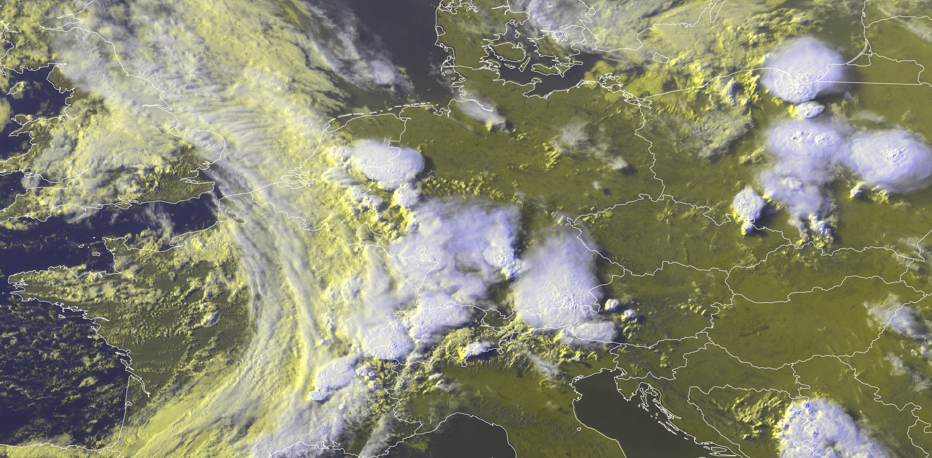
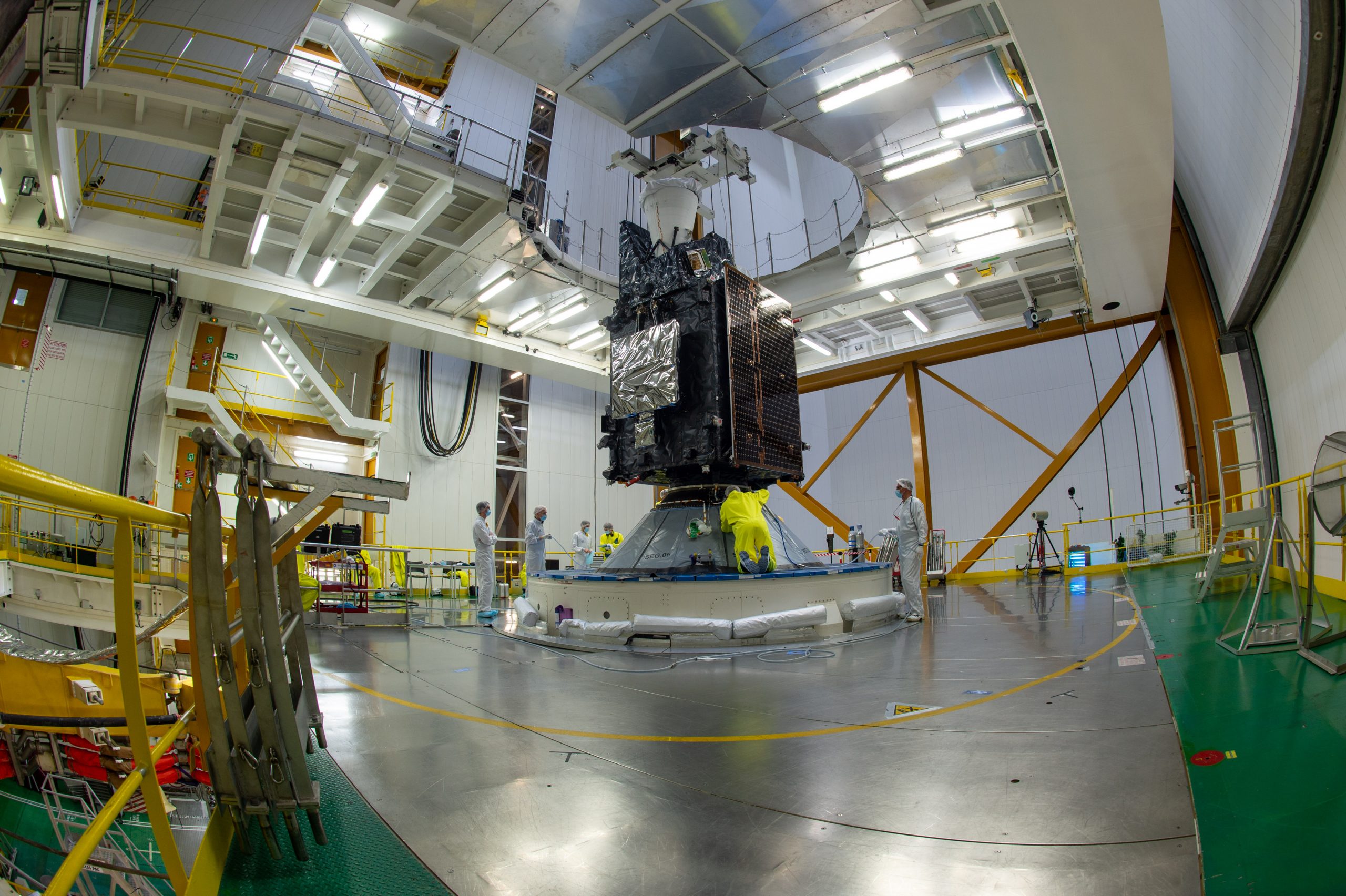
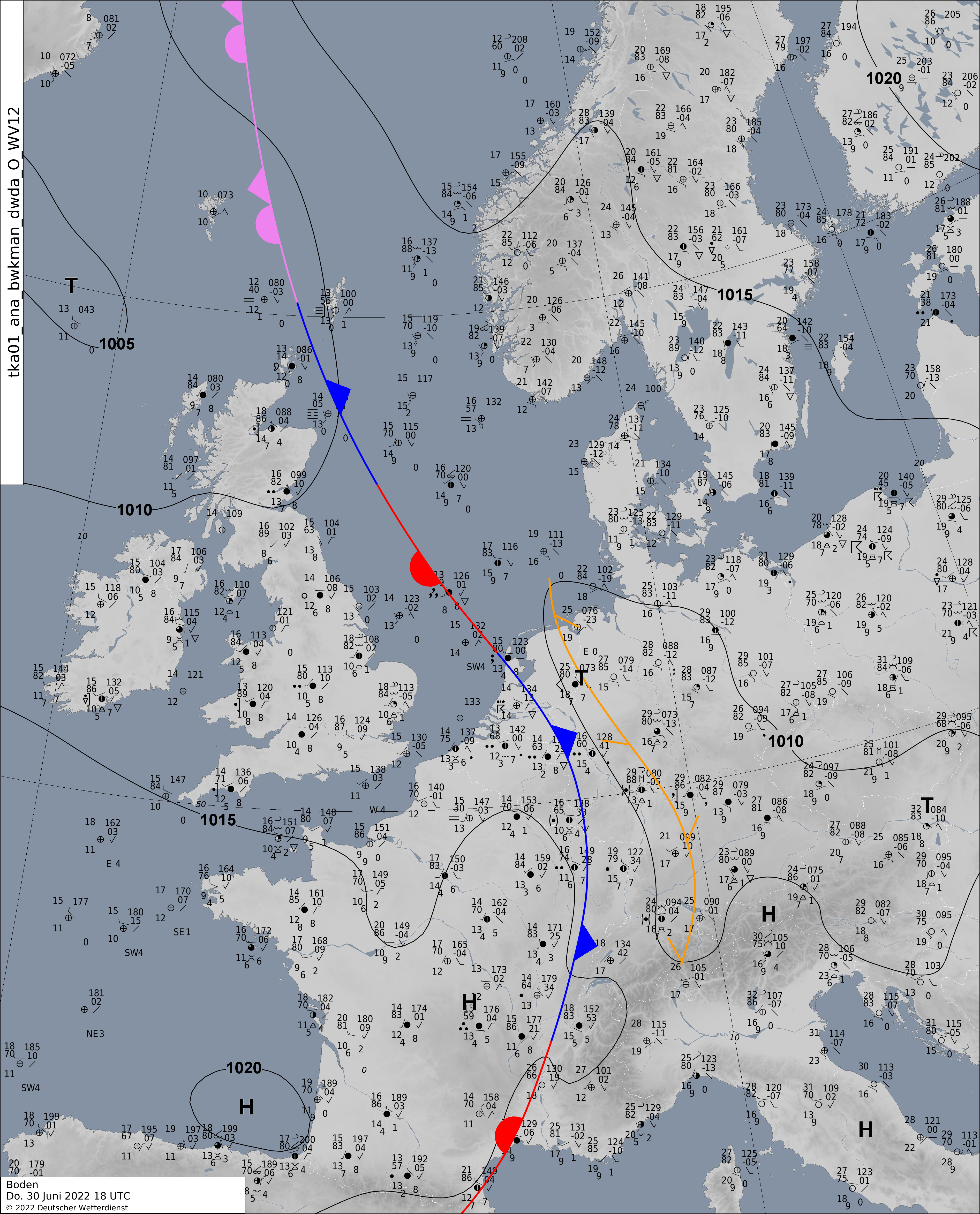
Everyone has seen these kinds of reports on the news ticker. This real example was the result of heavy thunderstorms that passed over large parts of Germany in the afternoon and evening of 30 June 2022, causing particularly severe damage in North Rhine-Westphalia, southern Bavaria and parts of Lower Saxony. The storms brought with them hail and lightning damage, landslides, flooding and several fallen trees. In some cases, strong thunderstorms harbour additional dangers, such as storm damage from downbursts or tornadoes. However, until now they have been considered extremely difficult to predict. One reason for this is that they are usually very local. With the launch of the first Meteosat Third Generation (MTG) satellite, Europe now has an eye in space capable of detecting these localised thunderstorms in real-time – or even predicting them far enough in advance to provide timely warnings.
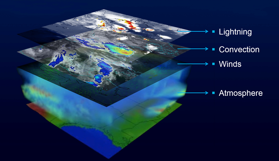
The first MTG imaging satellite (MTG-I1) will also automatically detect fog and forest fires. These capabilities are largely the result of the satellite’s two new instruments: the Flexible Combined Imager (FCI) and the Lightning Imager (LI). The FCI is the primary instrument on MTG-I1. It has 16 spectral channels and a resolution of 500 to 2000 metres, depending on the channel and operating mode. The time required to image the entire Earth disc visible to the satellite is 10 minutes. Using its ‘Rapidscan’ mode, Europe can be scanned with increased geographic resolution in just 2.5 minutes. The latest European weather satellite thus delivers twice the temporal and spatial resolution and 100 times the data rate of previous generations.
New generation of satellites to improve forecasts
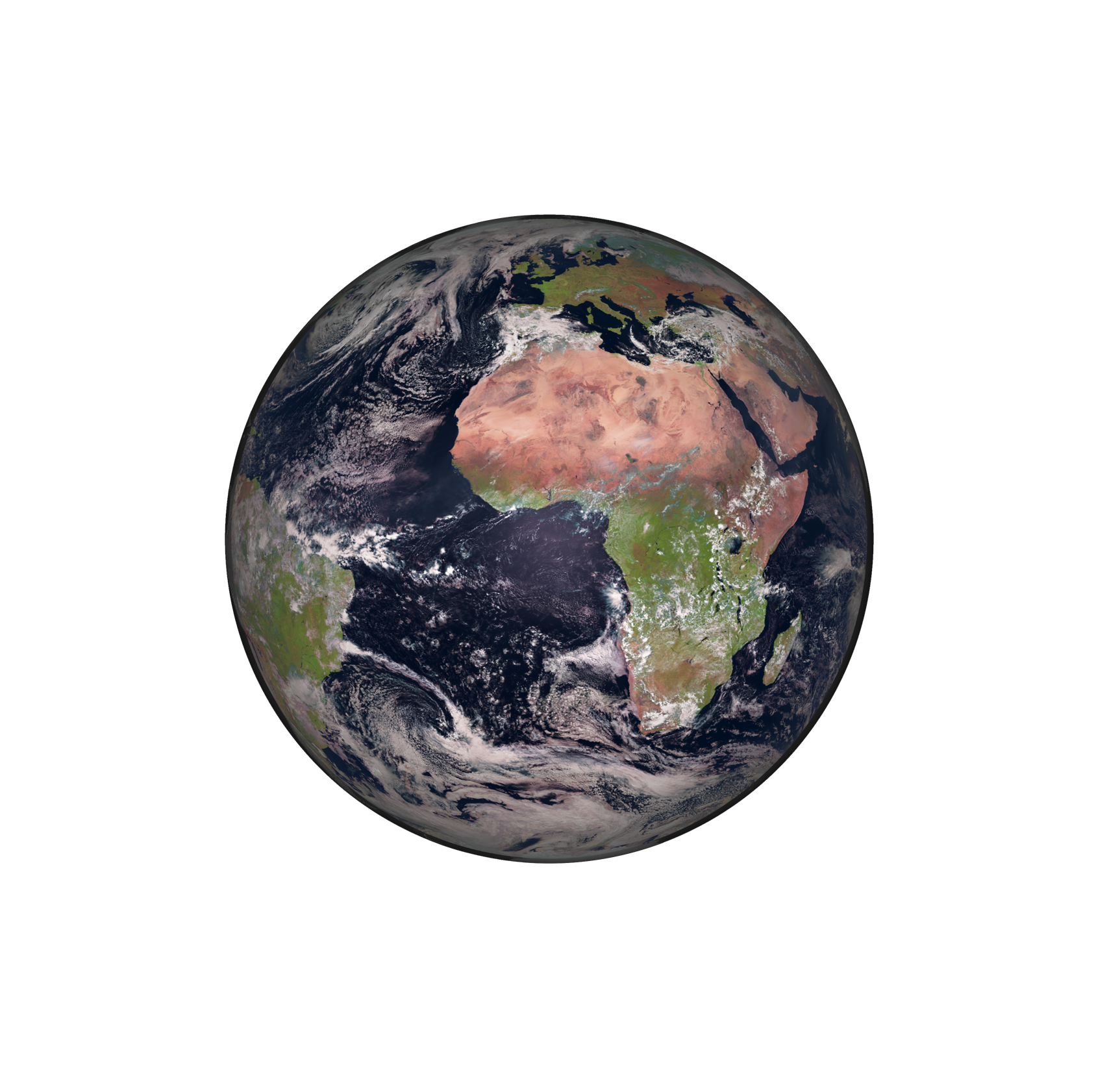
The German Weather Service (DWD) will be a major user of the data and expects that MTG will significantly improve measurements of humidity and cloud cover in the atmosphere, among other things. This will help make the forecasting of cloud shifts, and therefore also of heavy rain, temperatures close to the ground and solar radiation even more accurate. These data can therefore also make an important contribution to disaster management or the expansion of renewable energies. Thanks to the significantly higher spatial and temporal resolution of the measuring instruments, it will be possible to recognise thunderclouds more clearly and better estimate their lifespan. This will benefit aviation, for instance, which already receives thunderstorm forecasts from the DWD every 15 minutes during flight. In addition, MTG will be the first satellite to directly measure lightning over Europe and the surrounding seas.
Until now, these powerful electrical discharges have only been recorded by ground networks in Europe. Together, the two MTG instruments are expected to significantly improve thunderstorm forecasting. This will increase the safety and efficiency of air traffic, shipping and coastal protection. Policymakers, public authorities and the private sector will also benefit from the satellite, as the data provided by the satellite will inform them about foreseeable weather events at an early stage and give them time to prepare. For example, institutions responsible for public safety, such as fire brigades, coordination centres or flood response centres, will benefit from the comprehensive monitoring of weather events. Water management, agriculture and forestry, the energy and construction industries, the insurance sector and tourism, for example, also depend on precise weather information and forecasts.
Dr Christina Köpken-Watts
Scientific team leader for satellite data assimilation within the data assimilation section of the German Weather Service (DWD), Representative of Germany in the EUMETSAT Science Working Group (STG-SWG), Member of the IRS Mission Advisory Group (IRSMAG)Growing data volumes create challenges
DWD and all other national meteorological services in Europe will benefit significantly from MTG. Currently, the German Weather Service alone processes and verifies approximately 165 million weather observations every day, of which roughly five million observations are actively used for forecasting. Of these, approximately 85 percent are acquired using satellites. Since MTG provides approximately 100 times the amount of data collected by the current Meteosat Second Generation (MSG) satellites, the new generation of satellites will significantly increase the importance of satellites for all weather services in Europe. However, scientists and model developers in Europe face a major challenge: processing large volumes of data received every 10 minutes and incorporating them into their weather forecast models.
MTG-I1 becomes Meteosat-12
Dr Christina Köpken-Watts
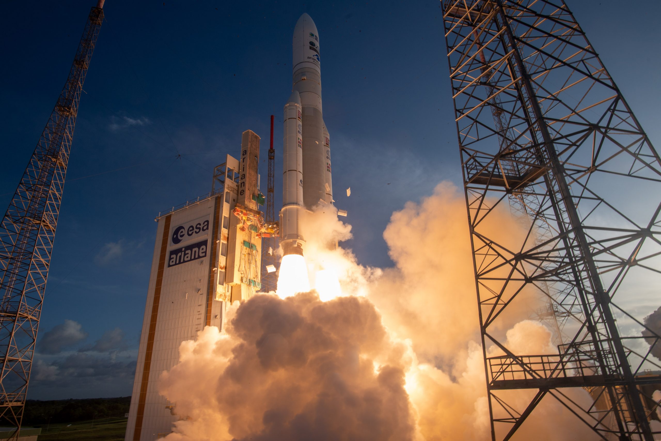
Scientific team leader for satellite data assimilation within the data assimilation section of the German Weather Service (DWD), Representative of Germany in the EUMETSAT Science Working Group (STG-SWG), Member of the IRS Mission Advisory Group (IRSMAG)Shortly after launch on 13 December 2022, MTG-I1 entered its Launch and Early Operation Phase (LEOP). During this phase, the satellite reached its target orbit, deployed its solar arrays and switched on its communication systems. On 28 December 2022, the LEOP was completed and the European Organisation for the Exploitation of Meteorological Satellites (EUMETSAT) assumed control of the satellite. In the subsequent Commissioning phase, the instruments are switched on, tested and calibrated in order to adapt the algorithms used to evaluate the data. The Operational phase of MTG-I1 will begin approximately one year after the launch. At this point, data products will begin to be transmitted to all European weather services, including the German Weather Service, within a few minutes of being acquired. The satellite will also be renamed ‘Meteosat-12’ at this time.
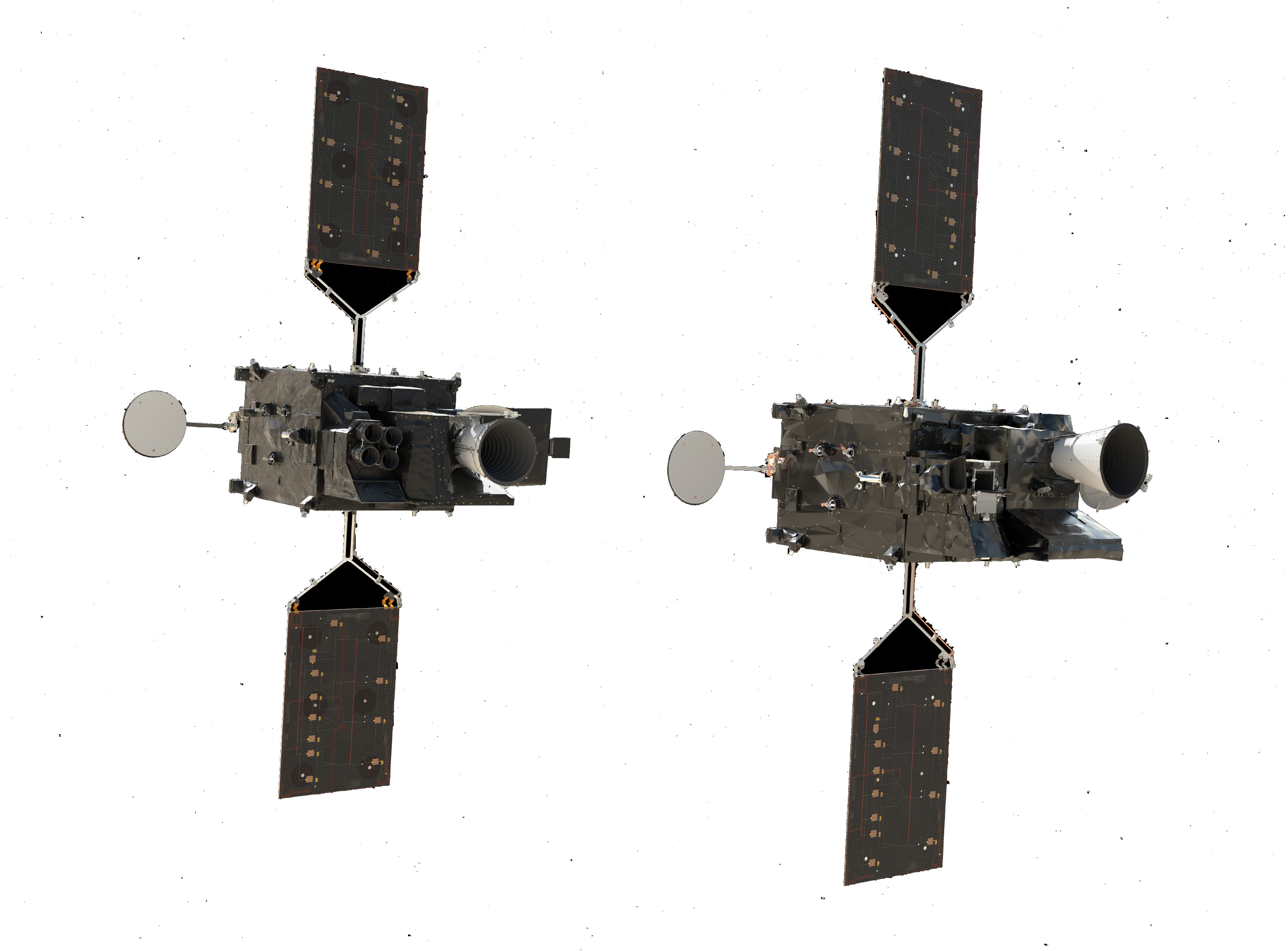
The MTG series was developed by the European Space Agency (ESA) on behalf of EUMETSAT and is intended to ensure and further improve the continuity of weather observation from space, which began in 1977 with METEOSAT-1. This new generation consists of a total of six satellites launched in series to routinely produce weather data for the next 25 years. MTG consists of two types of satellites: four satellites with imaging instruments called imagers (MTG-I1-4) and two satellites with spectroscopic instruments called sounders (MTG-S1-2). The main instrument on the MTG-S satellites will provide new data for forecasting extreme weather events. The launch of MTG-S1 is planned for mid-2024.
Dr Christina Köpken-Watts
Scientific team leader for satellite data assimilation within the data assimilation section of the German Weather Service (DWD), Representative of Germany in the EUMETSAT Science Working Group (STG-SWG), Member of the IRS Mission Advisory Group (IRSMAG)Significant German participation
Germany has a roughly 30 percent share in the development of the European MTG satellites. OHB is responsible for the construction of all six satellite platforms as well as for the InfraRed Sounder (IRS) instrument on the MTG-S series. The company Airbus DS is significantly involved in the development and construction of the Sentinel-4 instrument on the MTG-S series. The German Space Agency at DLR is responsible for technical support in the implementation of the MTG programme in cooperation with the German Weather Service, financed with funds from the Federal Ministry for Digital and Transport (BMDV).
